| |
|
|
|||||||||
|
Study Site
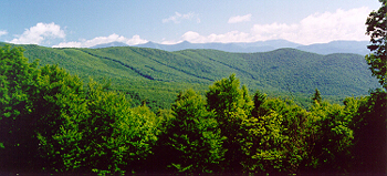
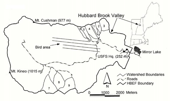
This study was conducted within the Hubbard Brook Experimental Forest, a 3,160 hectare (about 7,800 acres) reserve within the White Mountains of New Hampshire. Hubbard Brook is known throughout the scientific community for being part of a network of LTER (Long-Term Ecological Research) sites, which are funded by the National Science Foundation to conduct research on ecological processes across broad spatial scales and over long periods of time. The collective efforts of hundreds of researchers have generated a tremendous amount of long-term data on the hydrology of the region, the cycling of important nutrients like nitrogen and carbon, the impacts of disturbance events (e.g. ice storms), the causes and consequences of fluctuations in plant and animal populations, and many other facets of the ecosystem at Hubbard Brook. The research that has been conducted on Black-throated Blue Warblers has contributed to, and benefited from, the collective knowledge of ecological processes at the site. The "bird research area" is just over a mile past Mirror Lake and the building that houses the Hubbard Brook Headquarters (see map below). In 1969, Dr. Richard Holmes of Dartmouth College established a 10 ha (almost as big as 19 football fields) study plot in that area and began monitoring the bird community, going back each year to count all of the birds on the plot. That is, he counted every individual of every species! After getting some information on the community as a whole, he and his colleagues decided to focus more intently on the population ecology of one species - the Black-throated Blue Warbler. The 10 ha study plot was expanded to 64 ha (about the size of 120 football fields), and since 1986 all of the Black-throated Blue Warblers on the plot have been monitored to measure the average number of young each pair produced each year in relation to the environmental factors that affect warbler nesting success (predator abundance, food availability, density).
|
|||||||||
| Learning module developed by K. Langin, H. Sofaer and S. Sillett for the Hubbard Brook Research Foundation (2009). | |||||||||